Abstract: Khor Kharfot and Wadi Sayq are in the region that has become the premiere candidate for Nephi’s Old-World Bountiful. Out of the several matching criteria that has led to this opinion, the one that may be the weakest has been the identification of readily available ore in the area that Nephi could have used to manufacture the tools necessary to build his ship. This investigation, conducted in February 2023, found several distinct examples of iron ores suitable for ”smelting” in the form of float, all pointing to deposits yet to be located. Additionally, I review the investigation of Dr. Revell Phillips, who headed a group from BYU in 2000, that found two locations north of Khor Kharfot apparently containing significant deposits of iron ore. However, one site turned out to be problematic and the other site is too distant for Nephi to have been able to access it. Nonetheless, their efforts are reviewed as a backdrop for this current study. Also presented are findings regarding heretofore unrecognized features of Wadi Sayq and Khor Kharfot and the likely conditions that produced them, going back into the Pleistocene era.
In recent years, Khor Kharfot has been generally accepted as the location that best corresponds to Nephi’s Old World Bountiful. The promise of this site was first identified by Warren Aston after an exhaustive five-year survey and reconnaissance of the south to eastern coasts of the Arabian Peninsula in 1987–1992. In 2022, George Potter published an article promoting Khor Rori, which is located 38 miles (61 km) east of Salalah and about 95 miles (153 km) up the coast from Khor Kharfot, as the most likely Bountiful site (see figure 1).1 [Page 298]However, a more recent publication from Warren Aston provides a detailed comparison between Khor Kharfot and Khor Rori and shows the deficiencies of Khor Rori as a candidate for Nephi’s Bountiful.2
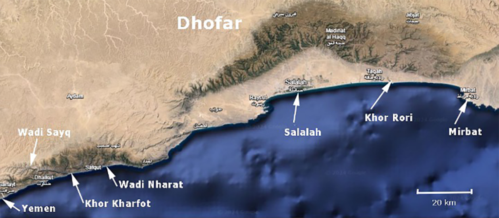
Figure 1. Southeast coast of Oman, Dhofar province.
Aston’s description of his investigation and their results is found in his book Lehi and Sariah in Arabia.3 Aston identifies twelve criteria garnered from Nephi’s description of the land of Bountiful that must be met for a site to be considered as Bountiful with any reasonable certainty. After presenting all the possible sites he found along the seacoasts of Dhofar (southwest Oman province) and Mahra (northeast Yemen province), he then demonstrated how Khor Kharfot is, by far, the best candidate. It closely matches eleven of the twelve criteria.
There is one of Aston’s criteria that, up to this point, has not been sufficiently verified or identified—the presence of the ore that Nephi was directed to obtain to make tools to build a ship. Infrequent patches of so-called iron-concretions have been identified in the limestones of the Khor Kharfot region, but these are quite wispy and unsubstantial and wholly inadequate to concentrate into useable ore.4
[Page 299]In 1 Nephi 17:9, Nephi asks the Lord where he should go to find the ore for his tools. The necessity of Nephi’s seeking the Lord’s guidance indicates that the ore was not underfoot, nor was it something Nephi could readily locate. This implies that our present-day efforts need to focus on areas not only within Khor Kharfot, but also in surrounding areas. Could Nephi’s ore have been something other than iron ore, possibly copper-tin (bronze) or copper-zinc (brass) alloys? Though there are exploitable copper deposits and small-scale zinc mining occurrences in the north of Oman,5 tin is never mentioned, with zinc only associated with the ophiolites of northern Oman.6 Additionally, Nephi’s account gives no hint that he had to deal with more than one ore type in either finding the deposits, smelting them, or creating an alloy of the mixture.
During investigations conducted in 2016–2017, a few float samples7 were discovered that give every appearance of being fairly high-grade iron ore, or that contain iron-rich sedimentary cement/content that may have been derived from richer ore deposits. This was confirmed in one of the samples using spectrographic element analysis.8 Consequently, the current study (conducted in February 2023) examined the possibility of ore being readily available in the Khor Kharfot region by searching out examples of high-grade iron ore in either float or in situ samples.9 Samples were to be sought throughout the Khor Kharfot and Wadi Sayq area, and in wadis tributary to Wadi Sayq. Additionally, any samples would be [Page 300]collected with the goal of finding and characterizing the actual ore deposits. These samples, to include those collected on previous expeditions, were then to be analyzed to evaluate their exact mineral composition.
Previous Investigation of Iron Ore in Dhofar Province
When investigators first started thinking about locating Bountiful, they took their cue from Nephi’s description of traveling “nearly eastward” (1 Nephi 17:1) from a place that was called Nahom, where Ishmael was buried (1 Nephi 16:34). Based on the probable but approximate location of Nahom and traveling due east would bring Lehi’s group to the south Arabian Peninsula coast somewhere in northeastern Yemen or southeastern Oman. Initially, the most obvious candidates were in the harbor areas of Salalah or Khor Rori, which currently and anciently were fruitful regions with good, semi-protected access to the sea. This area was the generally accepted location for Nephi’s Bountiful at the time and was the focus of the first expedition mounted to try to locate Nephi’s ore by a group mainly from BYU, headed by Dr. Revell Phillips. He gives an account of this expedition as well as an analysis of probable smelting techniques used by Nephi in an article published in 2000.10
Two areas were targeted by Phillips for his iron-ore search: Wadi Nharat and Mirbat.
Wadi Nharat
As is evident in figure 1, Wadi Nharat debouches into the sea and is a relatively short distance (1.75 miles; 2.8 km) north-northeast of the small fishing village of Rakhyut. It was selected by Phillips because a member of his group, who had been an oil geologist in Oman, remembered a small Paleozoic/Precambrian rock exposure at the mouth of the wadi. This was a type of rock deemed most likely to contain hydrothermal, ore-containing dikes (veins with intruded deposits).
Their investigation of this area allegedly revealed the presence of iron ore contained in carbonatites (igneous carbonates). However, Jason Aase, another member of Phillip’s team, calls them carbonate dikes emplaced by fluidization, and having more affinity to marine [Page 301]limestones.11 This means they would not necessarily have an igneous origin, and are a mixture of calcite (CaCO3) and siderite (FeCO3), with pods of almost pure hematite (Fe2O3) possibly present in areas where the dikes widen. Phillips describes one pod as measuring eight by ten feet, thus potentially providing ample ore for building tools.12 They reportedly collected ten samples from this location and analyzed six of them, which revealed iron content from 3 to 28 weight percentage,13 values that are somewhat less than one would expect from Phillips’s description of them.14
Wadi Nharat is especially pertinent to this study because of its proximity to Khor Kharfot and Wadi Sayq (approximately thirteen kilometers or eight miles north-northeast of Kharfot), making it a possibility for the source of Nephi’s ore. It could have been accessed by small boats/rafts and possibly by camel, though the several steep coastal headlands may have rendered the overland route too difficult to travel, especially if more convenient deposits were available.
However, a rather cautionary caveat regarding the Nharat site comes from Warren Aston, who has visited the location on three separate occasions.15 He has not been able to find the deposits described, nor does any sample from the site show any iron content. Other than Jason Aase’s analyses and the verbal descriptions by Phillips, the deposits at Wadi Nharat have yet to be mapped and adequately analyzed for mineral content.16 The site warrants a more exacting geologic survey of its possible potential.
[Page 302]Mirbat
The second likely location of iron ore was determined by the Phillips group to be east of the town of Mirbat, located 6 miles (10 km) east of the ancient port ruins of Khor Rori. Khor Rori is situated along an almost entirely enclosed lagoon, 38 miles (62 km) east of Salalah and approximately 89 miles (143 km) north-northeast of Wadi Nharat (see figure 1). The group was investigating ancient rocks exposed in erosional windows in the overlying thick deposits of Cretaceous/Tertiary limestones that dominate the Dhofar province. Phillips describes these ancient rocks as a broad expanse of Precambrian igneous/metamorphic “basement complex” deposits, likely to have been intruded by ore-rich dikes.
Again, they found carbonatite dikes rich in siderite/calcite. However, in this case, the siderite component was apt to have weathered into a “gossan-like mass of goethite/limonite ore (Fe2O3.nH2O).”17 They deemed this deposit as the most significant one yet encountered and focused on data garnered from it for further studies.
The study of the Wadi Nharat and Mirbat sites is important, not only because of the iron ore located there, but because the described environments may be similar to those containing iron ore closer to Khor Kharfot. I found strong hints in this study that this is the case.
Samples Found at Wadi Sayq and Khor Kharfot
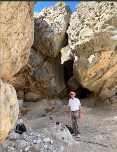
Figure 2. Team member Jon Groneman, standing next to several large interlocking boulders in Wadi Sayq’s thalweg.
The primary focus of this study envisioned searching for more iron-related samples or deposits closer to the most likely candidate for Bountiful, namely Khor Kharfot and Wadi Sayq. This would entail a search for iron ore float samples located along the Khor Kharfot inlet and along the length of Wadi Sayq leading into it. The idea was that the actual source deposit of the float samples would be found close to where float samples were no longer apparent, either close to the wadi’s thalweg18 or somewhere up either of its enclosing sides. What was not anticipated was the extremely rugged terrain that would be encountered going up the grade of the wadi. Due to time and manpower constraints, our team fell short of locating the actual deposits. Examples of this rugged terrain are seen in figure 2, showing gigantic, interlocking boulders in an area beyond the junction of Wadi Sayq with Wadi Kharfot. Figure 3 shows the boulder-strewn terrain at the [Page 303]tail-end of Wadi Sayq just before it enters one of the ponds at the west end of Kharfot Lagoon.
The presence of large boulders
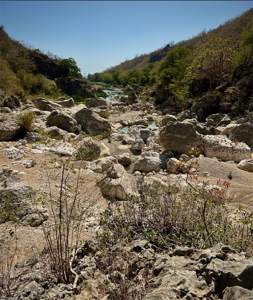
Figure 3. Boulder field at the lowest point of Wadi Sayq with a pond at the west end of Kharfot Lagoon visible in background.
The incredible jumble of boulders at the lowest point of the wadi is due to the loss of the Wadi Sayq gradient as it meets the lagoon area. It can be seen on Google Earth to continue almost unabated up to a point in the wadi halfway to where the highway crosses it. Figure 4 shows Wadi Sayq from Kharfot Lagoon up to the highway crossing near the western end of the image. The label “Max Boulders” shows the start of the boulder concentration. Figure 5 shows this abrupt terrain change. Further up the wadi, boulder patches are much more infrequent. They mostly consist of one or two boulders in the ten- to thirty-foot diameter or greater size range. Some of these show a few smaller boulders that have accumulated around them. The large boulders (figure 2) are likely to be located at or close to the area in which they landed after falling from the surrounding cliffs. They are much too large to have been moved very far by the force of water, either in the present or anciently.
[Page 304]
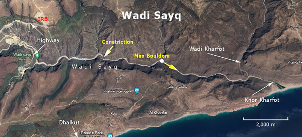
Figure 4. Overview of Wadi Sayq, extending from Khor Kharfot lagoon to the highway crossing shown at left of image. This investigation was limited to the wadi to the east of the highway, though the wadi also extends several miles west of this point.
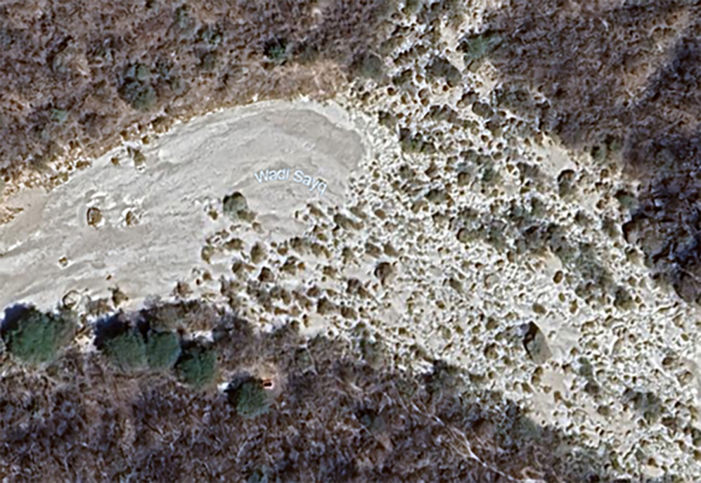
Figure 5. Point in Wadi Sayq where terrain starts to be dominated by boulders.
A reasonable explanation for the concentrated boulder field in the lower wadi is suggested by strong evidence that the sea level was over 400 feet lower during the Last Glacial Maximum (LGM; approximately 20,000 years ago) than where it is now, and only reached its [Page 305]present level about 7,000–8,000 years ago.19 Three situations logically follow from this:
- The gorge near the present outlet at the lower sea level would have been much deeper.
- As the sea rose, the deeper gorge would have filled in with sediment to a higher level resulting in a wider lagoon valley than the wadi leading into it.
- Boulders would not only build up at the lagoon/wadi junction because of the loss of gradient, but would start backing up behind this junction over time.
It should be mentioned that in the present day, water only flows in the wadi during the rainy season driven by the Khareef Monsoon, which is active from June into September. Additionally, devastating cyclones strike the region every four to ten years causing massive flooding and destruction. The last two cyclones occurred in May 2018 and October 2021, which resulted in the semi-permanent sand bar across the Kharfot Lagoon temporarily blowing out, emulating how it might have been anciently.
Ancient climate regimes affecting the Wadi Sayq and Khor Kharfot regions
Linda Pappas Funsch has spent the last eighteen years doing service work for the Omani Ministries. She first visited Oman in the 1970s and echoes the apparently common opinion that, “Oman enjoyed a relative abundance of water in ancient times.” She further notes that the pre-Islamic Persian Sassanid occupiers of Oman called it “Mazoun from the word muzn, suggesting clouds and abundant flowing water.”20 Iftikhar Ahmed Abbasi cites pollen data collected from the Dhofar province which supports a wetter climate there anciently.21
Evidence has also been collected for the existence of perennial [Page 306]paleolakes and paleowater channels in the eastern and western portions of the Rub’ al-Khali or Empty Quarter, impinging the northwest border of Oman, and for smaller ephemeral intradune paleolakes22 in other areas of the Rub’ al-Khali desert. This pluvial regime was present as recently as the mid-Holocene (5,500–7,000 years ago), with the remains of large mammal species being found around the large paleolake Mundafan, in the west of this region (e.g., wild goat and sheep, oryx, gazelle, horse and ass, camel, wild cattle, hippopotami, and birds such as ostrich).23
Additional data that underscores the earlier wetter climate in southern Oman comes from studies of oxygen isotope content in dated stalagmites found in caves.24 The Omani studies indicate that there was a gradual decrease in precipitation from very abundant rainfall amounts 8,000 years ago, to what we see today. The studies also suggest this trend was caused by a southward moving Intertropical Convergence Zone (ITCZ) driven by an orbitally induced25 reduction in the summer insolation (solar radiation).
The wetter climate is also confirmed by a study of the sediment configuration and pollen content from both Khor Rori and Khor Al Balid (seaward from Salalah).26 The findings of this study are important because they indicate a perennial water flow into these estuaries [Page 307]prior to the AD 270–420 timeframe that was sufficient to prevent long-shore currents from building sandbars blocking them. The study also concludes this was a regional phenomenon strongly implying the absence of a sandbar blocking Khor Kharfot prior to this time.
A more open lagoon—effectively, an estuary—would facilitate Nephi being able to launch his ship into the open sea. In any case, any monsoonal flooding, during that time or later, would be sufficient to help dislodge massive boulders from the overhanging cliffs and move smaller ones down the wadi.
George Potter maintains that there is no evidence that Khor Kharfot was anciently in the form of a harbor or estuary that could protect a moored ship, or one being built on a ramp, from tidal/storm surges and monsoonal winds.27 He adds that it was further lacking in having anything like a breakwater to afford minimal protection. What he hasn’t considered, however, is that the ancient, more intense fluvial regime could have not only kept the inlet open, but could produce strong enough currents to prevent sediment build-up in the “harbor” by moving it out over the off-shore shelf. This would intensify during monsoonal and cyclone episodes and would tend to counteract concurrent storm surges. The result would be a much deeper harbor than the present lagoon suggests.
Additionally, it must be noted that Wadi Sayq and its ending lagoon valley impinges on the coastline generally at about a twenty-five-degree angle, with the last quarter mile making a sixty-degree angle with the shoreline. This means wave/surge momentum (perpendicular to the shoreline) would be deflected from moving directly up the quarter-mile mouth of the harbor by something close to thirty-three percent and by seventy-three percent from moving directly up the continuation of the harbor. In effect, this configuration would act as a breakwater or jetty in relation to the westernmost parts of the harbor.
An additional wrinkle in this climate scenario, which may have impacted the Lehite sojourn at Khor Kharfot, was the onset of colder temperatures from about 750 to 550 BC with the convergence of the Homeric Solar Minimum.28
As an aside, after the experience of trying to navigate the section of the boulder-strewn wadi we traversed, and taking note of the thick vegetation covering the steep slopes of the wadi, we find it very difficult [Page 308]to believe that Lehi brought his entire caravan along the full length of Wadi Sayq to Bountiful. It is more likely that he would have followed the wadi thalweg, if at all, up to the point where the massive boulder accumulation started in his time, but then would move higher up the sides or on top of the wadi ridge for the rest of the journey, before dropping down into the lagoon. Traversing the boulder terrain is not only slow and cumbersome, but rather dangerous, especially for a large group. The ridgelines defining the wadi still point to the lagoon inlet, which is visible from many vantage points along the ridges. A recent article by Warren Aston explores the possibility that Lehi’s group entered Khor Kharfot from Wadi Kharfot which, though narrower and steeper than Wadi Sayq, may be more passible.29
Major constriction in Wadi Sayq channel
Another aspect of Wadi Sayq worth noting is a significant and unusual constriction of the waterway located about halfway between the start of the boulder fields and the highway crossing of the wadi (figure 6; labeled as Constriction in figure 4). It appears to be a very narrow channel with a possible steep drop-off and is constrained by a cliff on its east side. A closeup of this constriction reveals a very dark rock type in the cliff, the significance of which may indicate it is much harder/denser than the normal limestones of the region. If so, it is not easily eroded and is possibly an expression of the more ancient bedrock in which intrusive dikes containing ore deposits might be found. Any erosional window into the subbasement along the thalweg would be located in the older Cretaceous limestones on its north side. This is because the Tertiary limestones on the south have dropped down along normal faults defining the east-west trace of the Wadi Sayq thalweg to be even with them.30 This warrants further investigation.
[Page 309]
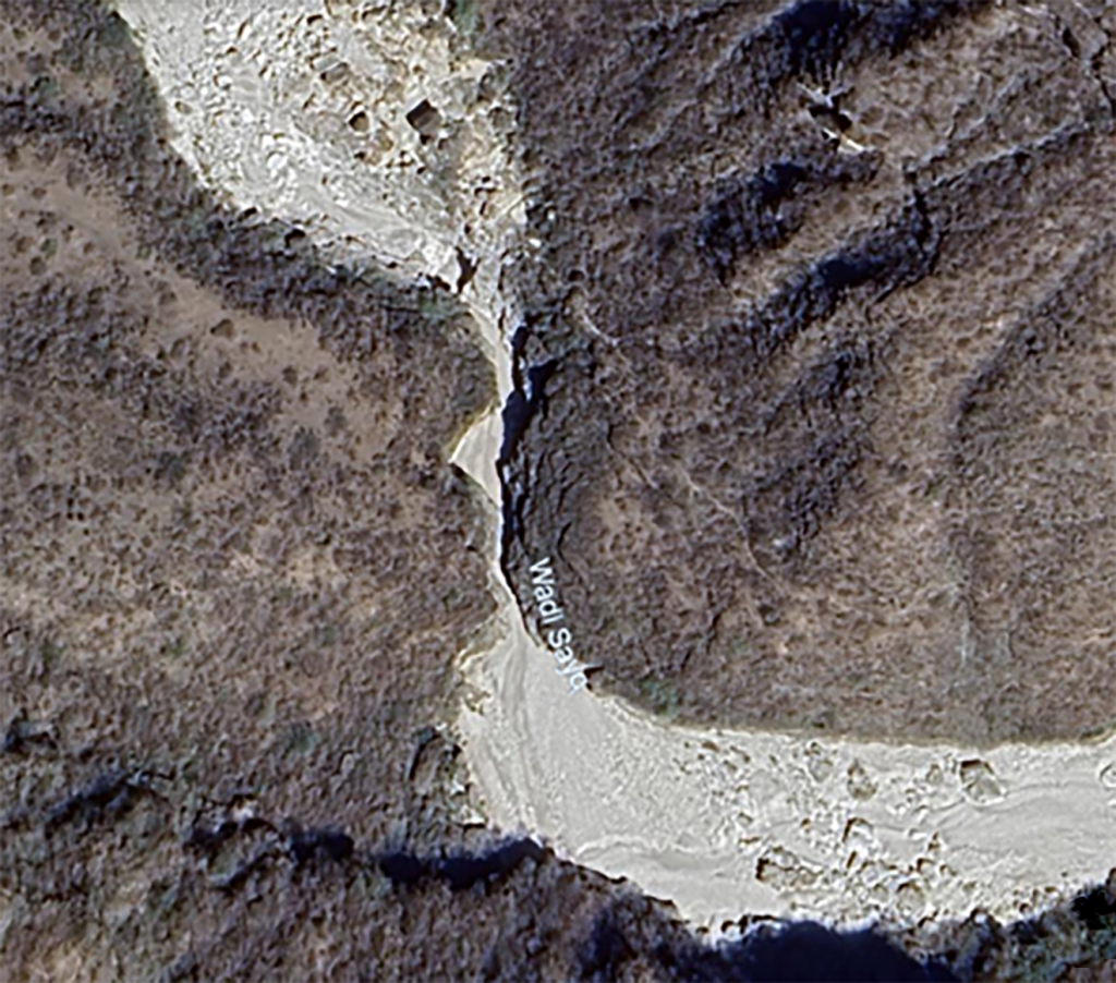
Figure 6. Unusual Wadi Sayq channel constriction.
Though progress in traveling up the wadi was constrained, we did find float samples of high-grade iron ore in the area we examined. These, added to those found on earlier expeditions, may have been derived or degraded from the original ore source or accompanying igneous injection. Additionally, one example of dike/vein filling outcrop in the form of a large, mostly buried boulder was discovered and photographed (figure 7) and suggested the occurrence of Precambrian/Paleozoic basement rocks noted above.
Sample preparation and analytic technique used
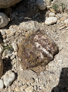
Figure 7. Possible Precambrian/Paleozoic boulder showing vein dikes.
The analytic techniques selected to characterize these samples was three-fold. First, the density of the entire sample (whole rock) was determined for screening purposes and to supplement mineral content data.31 [Page 310]Second, X-Ray Diffraction (XRD) analyses were performed on 10–30 gram portions (splits) of these samples to give a semi-quantitative assessment of their mineral content.32 Third, post-analytic densities of the splits were determined using the weighted averages of mineral components coupled with the density of each component.33
It is noteworthy that the densities determined for the 10–30 gram sample splits were quite close to their whole-rock densities, though generally showing slightly higher values. These higher values are likely due to porosity (voids) present in the large samples that are absent in the ground-up sample splits. Any drastic difference between the whole-rock and split densities would indicate problems with the analytic result.
Sample characterization
Float samples collected from the Khor Kharfot/Wadi Sayq site, coupled with similar samples collected on earlier expeditions, could be visually categorized into three separate groups:
- Those showing obvious and major hematite (Fe203) or goethite/limonite content (Fe2O3.nH2O) or combinations of the two, which constitute viable iron ore. The goethite/limonite dominated samples are likely produced by alteration of the purer iron-oxides by surface conditions, i.e., hydration.
- Samples exhibiting sedimentary characteristics and [Page 311]containing smaller amounts of hematite/goethite/limonite. They are also, by far, the most prevalent iron-containing samples encountered along the terrain investigated but would be of questionable use as iron ores.
- Crystalline samples that don’t fit the normal Cretaceous/Tertiary limestone provenance of the region. Except for possible iron-staining, these samples lack iron content and may be related to the Precambrian/ Paleozoic basement rocks into which the ore-veins were intruded. Included in this group are recrystallized calcite limestones that appear anomalous to the normal limestones of the area.
The entire length of terrain sampled is shown in figure 8, delimited by green vertical lines. The area begins at the beach strand blocking the eastern terminus of Kharfot Lagoon and its ponds, up to where it meets Wadi Sayq (0.8 miles; 1.3 km); the segment of Wadi Sayq from this point to where Wadi Kharfot enters it (0.4 miles; 0.6 km); and from this junction to a point further up the wadi (0.75 miles; 1.2 km). The general locations of samples are shown in yellow (abundant iron oxides) and red (lesser or no iron-oxides).
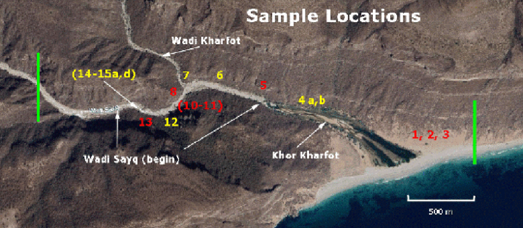
Figure 8. Study area and general sample locations (yellow and red numbers).
Sample analysis
What follows is a catalogue of the selected float samples that were found in the Khor Kharfot/Wadi Sayq region to date and were deemed worthy of analysis. This included their mineral compositions and significance. Samples in each category will be described in the order of closest to furthest away from the Khor Kharfot beach. The samples collected that were of most interest and are most pertinent to the [Page 312]purpose of this study are those that show significant amounts of iron-bearing minerals, normally in the form of hematite and goethite. There were seven samples in this category. It should be noted that, except for one of the iron-abundant ore samples, any amorphous or poorly crystalline component of the samples was left undetermined by the semi-quantitative XRD method used. The content of the known components was normalized to 100 percent.
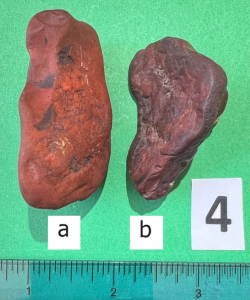
Figure 9. Sample 4; abundant hematite.
The first two samples from this group were picked up during the 2017 field season from a location near the west end of the Kharfot Lagoon (see “Wadi Sayq (begin)” in figure 8) and are labeled 4a and 4b as shown in figure 9. They appear to be pure hematite, yet their analyses indicate hematite content of only 64.4 and 73.5 weight percentage, with the remaining content consisting of quartz. The lesser amount of hematite in Sample 4a is reflected by its greater abundance of quartz (35.6 %), with sample 4b having only 26.5% quartz.
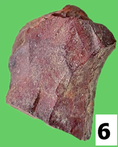
Figure 10. Sample 6; significant hematite.
The next ore-related sample is sample 6, shown in figure 10. This is one of two or three similar samples collected by Scott Gubler of Deseret Laboratories, in the boulder region between the west end of Kharfot Lagoon up to the junction of Wadi Sayq with Wadi Kharfot. Hematite content is 17.2%, with quartz being the remaining content. Visual inspection suggests the hematite content should be greater. Unfortunately, we don’t have a whole-rock density value for this sample to help assess this. The red appearance and high quartz content [Page 313]suggests it could be an iron-rich jasper, where hydrothermal activity was likely involved in its creation, thus making it more likely to be derived from intruded Paleozoic horizons.
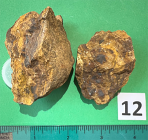
Figure 11. Sample 12; significant goethite.
Sample 12 (figure 11) was located just upstream beyond the junction of Wadi Sayq and Wadi Kharfot. It contains 30.9% goethite, which is reflected by its higher density of 3.35 gm/cm3; and with most of the remainder of the sample consisting of calcite (68.3%). This fits the profile of samples collected by Phillips at Mirbat, which also contained much goethite or hematite mixed with calcite, the significance of which will be discussed below.
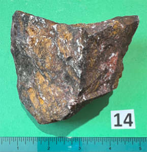
Figure 12. Sample 14; abundant goethite and hematite representing about two-thirds of the original sample collected.
Sample 14 (figure 12) is probably the most striking example of iron ore collected. It has every appearance of being rich ore—both by density (4.8 gm/cm3; density of pure hematite is 5.3 gm/cm3) and mineral content, color, and streak—with both goethite and hematite phases. It was found near the upper end of the sampling terrain. It exhibits almost no erosion, which implies a nearby location for the deposit of origin. Surprisingly, the iron-mineral bearing content registers only 46% goethite and a mere 10.7% hematite, yet allegedly contains 42.6% calcite.
Despite this relatively high iron content, the whole-rock density of the sample indicated there should be even more iron and much less calcite than showed up in the XRD analysis. Consequently, this sample was re-analyzed by Activation Laboratories to determine possible amorphous content that lacks the course crystallinity that would show [Page 314]up in regular XRD analysis. The results indicated an amorphous content of 35.3 weight percentage.
The most likely cause of the underrepresentation of iron in sample 14, to include its abnormal amount of calcite, is a lack of homogeneity in the sample. In other words, the split taken from sample 14 may have been from an area containing lower than average iron oxide content relative to the calcite content. Additionally, missing iron might be present in the amorphous phase in the form of limonite. Visual inspection of sample 14 does show a significant and distinct presence of an orange mineral(s), most likely consisting of a mixture of limonite and goethite, where limonite is amorphous and will not be detected by XRD.
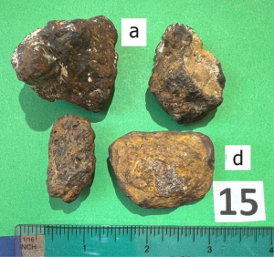
Figure 13. Sample 15a (upper left); 98% hematite and goethite. Sample 15d (lower right); pure goethite.
The last of the iron-rich ore samples constitute four large pebbles (figure 13) that were located approximately fifty feet up-wadi from sample 14, and all within about a two-foot square area. Only the darker upper-left (labeled 15a) and lighter lower-right (tan-gray-yellow, labeled 15d) large pebbles were analyzed. The darker large pebble contains 65.4% hematite and 33% goethite for a total of 98.4% iron-oxides; and the lighter large pebble consists of 100% goethite. The densities of these samples are commensurate with the indicated mineral content.
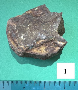
Figure 14. Sample 1; approximately 7% goethite/hematite.
These samples indicate there is high-grade iron ore from which tools could be made in the Khor Kharfot region, which would have been quite accessible to Nephi.
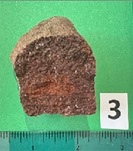
Figure 15. Sample 3; approximately 10% hematite, 74% calcite.
The next group of samples containing smaller amounts of goethite and/or hematite give every appearance of being sedimentary, having medium to large amounts of quartz or calcite. They include sample 1 (figure 14), which is mostly quartz (94.9%), but contains goethite (5.5%) and hematite (1.2%); sample 3 (figure 15), containing quartz (16.1%), hematite (9.9%), and calcite (74%); and sample 11 (figure 16), discovered in the area well beyond the junction of Wadi Sayq and Wadi Kharfot, containing quartz (60%), calcite (34%), and goethite (1%). Sample 11 is also unusual because of its yellowish color and having small amounts of the igneous-derived minerals albite (1.9%) and K-Feldspar (2.1%), as [Page 315]well as kaolinite (1.9%). Samples 2, 8, and 10, shown in figures 17–19, were not analyzed because of their similarity to samples 1 and 3.
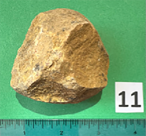
Figure 16. Sample 11; 1% goethite in quartz/calcite.
Hand lens inspection of fresh surfaces of these samples show rounded quartz grains, of either medium or fine to very-fine sizes, depending on the sample, amid hematite or goethite cement. However, sample 3 (74% calcite) also exhibits what appears to be small sedimentary oolites (rounded calcite grains). The question remains, however, whether or not these float samples were redeposited directly from original Paleozoic iron ore containing deposits before deposition of the Cretaceous/Tertiary limestones, or originated from iron-rich sedimentary horizons within the limestones.
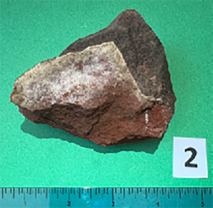
Figure 17. Sample 2; sedimentary and iron rich.
[Page 316]Evidence for the later possibility is the recent finding and sampling of a bed of iron-rich-appearing red-brown rocks by Warren Aston (see IRB, figure 4; and figure 20) at the top of the road cut as it comes out of Wadi Sayq to the north. This bed shows no similarity to the ferruginous hard grounds or iron concretions mentioned by Abbasi.34 The bed is located at the top of the Tertiary rock sequence of this area (base of the Rus Formation). A possible origin for it may have been the introduction of bog iron into a swampy region that came into existence when the sea temporarily receded.
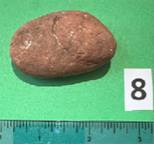
Figure 18. Sample 8; sedimentary and iron rich.
The presence of albite and K-Feldspar in sample 11 may be an indication it was redeposited from eroded Paleozoic outcrops before the Cretaceous/Tertiary limestones were laid down.
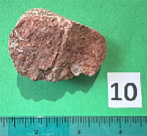
Figure 19. Sample 10; sedimentary and iron rich.
The last few samples analyzed (5, 7, 13) contain no noticeable iron and are very similar in composition, showing mostly calcite (94.2–98.4%) and a small amount of quartz (0.4–1.6%). Two of the samples contain 2.2% and 5.4% dolomite. Sample 5 has a dull-gray-to-magenta coloration and a course crystalline fabric consisting of approximately 0.2–0.7 mm crystal sizes. Sample 7 (figure 21) exhibits a brown-red phase (the phase analyzed) filling voids/cracks in a gray dolomite. Sample 13 (figure 22) has a tan to orange colored matrix with multiple small pores or voids. All three samples give the appearance of having undergone significant alteration (diagenesis) that involved calcite recrystallization coupled with elevated heating, a possible indication they originated from the Paleozoic intrusive process already noted.
[Page 317]
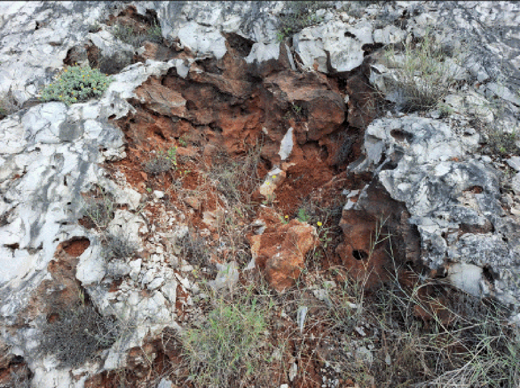
Figure 20. Iron-rich red bed at location IRB in figure 4.
Extent of Nephi’s Knowledge of Metallurgy
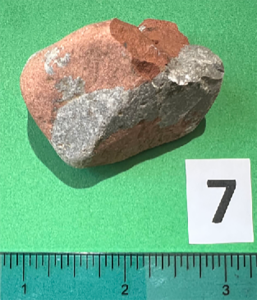
Figure 21. Sample 7; two-phased; similar to sample 5 in content.
Nephi was commanded by the Lord to build a ship so that the Lehite party could journey over the ocean to the promised land. Confronted with this command and realizing he had no tools to do such a thing, [Page 318]Nephi asks the Lord: “whither shall I go that I may find ore to molten, that I may make tools to construct the ship after the manner which thou hast shown unto me?” (1 Nephi 17:9). He then recounts “that the Lord told me whither I should go to find ore, that I might make tools” (1 Nephi 17:10). Whereupon Nephi builds a skin-based bellows and starts a fire so he can “molten” the ore. In chapter 17, he laconically states, “And it came to pass that I did make tools of the ore which I did molten out of the rock” (1 Nephi 17:16). This is quite scant information about how Nephi arrived at this point.
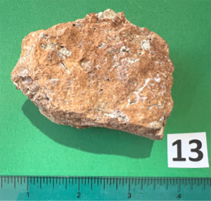
Figure 22. Sample 13; recrystalized calcite, iron stained. No dolomite.
Revell Phillips notes that the Chinese were melting iron out of ore rock and pouring it into molds as early as 800 BC, probably because they had been experimenting with very high temperatures in working with porcelains.35 This technology was not available in Israel during Nephi’s time, where they would be limited to creating iron in a solid form at a much lower temperature than the melting point of iron (2,192° F or 1,200° C versus 2,795° F or 1,535° C).36 This temperature was reached by burning charcoal with forced air (Nephi’s bellows), producing excess heat and carbon monoxide (CO). Carbon monoxide is the agent that reduces the iron ore to elemental iron in the form of a solid sponge-iron bloom. It would also actually melt the impurities mixed with the ore, but would not have resulted in a pool of molten iron that could then be poured into a cast. The bloom would also have to be hammered into the shapes desired.37
Webster’s 1828 Dictionary defines molten as the “‘participle passive’ of melt. Melted. 1. adjective Made of melted metal; as a molten image,”38 which seems to contradict both Nephi’s use of the word and our understanding of what Nephi would be able to do using his own devices. There are three obvious possibilities for resolving this contradiction:
- Nephi is conflating his use of the term, perhaps due to his actual knowledge of how other metals such as copper and bronze are derived from actual melts.
- The Lord told him how to achieve the high temperatures to melt iron ore.
- [Page 319]He is referring to a portion of the iron smelting process, which does achieve a molten state, namely the slag.
Getting direction from the Lord in how to do this seems unlikely because Nephi gives no hint that this is the case, yet readily mentions direction from the Lord in finding the ore, how to build the ship, and in many other situations.
Several scholars, including Phillips, mention the likelihood that Nephi had already acquired the knowledge of how to work iron and perhaps other metals, either from earlier training or fairly recent observations on how it is done in areas he had visited.39 This is reinforced by Nephi’s statement much later after arriving in the Promised Land that “I did teach my people to build buildings, and to work in all manner of wood, and of iron, and of copper, and of brass, and of steel, and of gold, and of silver, and of precious ores, which were in great abundance” (2 Nephi 5:15).
Phillips writes that the type of iron derived from a bloom is called wrought iron and is very malleable and soft, requiring it to be worked in several ways before it can be made into useful tools and implements. Forging or hammering the bloom to drive out additional impurities offers no further improvement beyond a certain point. The techniques Phillips cites that Nephi probably had knowledge of were:
- Carburization, which involves heating the wrought iron over a period of time while it is in contact with glowing charcoal, resulting in carbon atoms penetrating the outer layers, which creates a very hard, steel-like surface.
- [Page 320]Quenching, where the hot steel/iron is plunged into water, thereby, further hardening it, but also making it more brittle.
- Tempering it to make it less brittle, yet retaining its hardness, accomplished by reheating the metal to moderate temperature (red-hot) followed by slow cooling.40
This means that Nephi’s use of the term molten is most likely his catchall term for working with metal-bearing ores. In the case of iron-smelting, it would likely refer to his awareness of an actual melting phase of the slag that is produced.
Another question that arises regarding Nephi’s probable use of a bloom from the ore to make his tools, is how he was able to hammer the bloom into shape in the first place with no tools yet in his possession. Phillips suggests that it would be logical for Lehi to have included at least a hammer and ax as part of the equipment he assembled for his journey.41 This is even more plausible if Lehi were a caravan merchant, for which Hugh Nibley strongly made the case.42 What better tool to have for driving tent stakes into rough ground, for instance, than a good iron/steel hammer, let alone other tools that might be necessary for certain needs that would arise in a caravan expedition.
There is an additional aspect of the ores surveyed by Phillips near Mirbat, which may be like the ores used by Nephi. This involves the presence of significant amounts of calcite in the so-called carbonatites and hematites. Calcite/limestone is known to act as a flux that entrains and melts impurities contained in iron ores (for example, silicates). It effectively lowers the temperature needed to do so.43 This allows for a lower overall temperature needed to create the iron bloom. Three of the iron ores collected in this study contained significant quantities of calcite.
Summary and Conclusions
The most important result of this study was discovering high-grade iron ore samples in the Khor Kharfot and Wadi Sayq region. These [Page 321]samples strongly imply the presence of the originating deposits in the same area, which would provide an accessible source of iron ore for making the tools Nephi would need to build his ship. Warren Aston compared twelve specific criteria from Nephi’s description of Bountiful with the physical features at Khor Kharfot. The only questionable item was Nephi’s claim to have accessed iron ore to make his tools. The findings of this present study go a long way to satisfy this final link between the scriptural account and the features on the ground at Khor Kharfot. The samples described in the study likely derive from hydrothermal veins/dikes deposited in much older Precambrian/Paleozoic basement deposits and not in the overlying Cretaceous/Tertiary limestone deposits that characterize this region. This would make their originating deposits very much like those described earlier by Revell Phillips and his team during their investigation of iron ore deposits in the broad area of the southern Dhofar province of Oman.
The only difference between Phillips’s iron-rich samples and the float samples collected in this study is the absence of siderite in the float samples. Otherwise, they both contain either hematite or goethite or mixtures of these two iron oxides and many of these contain calcite components, which lowers the temperature needed to smelt the ores into iron.
This investigation also discovered features of Wadi Sayq and Khor Kharfot, coupled with supporting evidence, that would have affected the success and general operation of Lehi’s group in this area. For instance, several lines of evidence indicate the region was much wetter and perhaps cooler during Lehi’s sojourn, possibly allowing the Wadi Sayq water course to be perennial and strong enough to keep the inlet open year-round. This would greatly facilitate launching Nephi’s finished ship. Additionally, the configuration of the Khor outlet indicates it would act as a breakwater providing protection from storm surges and surf, which could otherwise disrupt Nephi’s ship building efforts. Finally, the intense boulder field of Wadi Sayq and the probable reasons for its build-up likely prohibited the group from coming directly into Khor Kharfot via the lower reaches of the wadi.
Phillips and his team determined that Nephi was probably well-versed in the production of metals from their ores, but did not produce an actual iron-melt. Instead, he was working with sponge iron produced at temperatures below the melting point of iron. Furthermore, in the possibility that Lehi was a caravan trader, Nephi undoubtedly had [Page 322]access to a minimal array of tools that he could have used to work the sponge iron into appropriate tools for shipbuilding.
Further research is needed to locate the source of the iron-rich float samples described in this study. A promising target might be the extreme constriction about halfway up Wadi Sayq, indicative of a probable erosional window into a Paleozoic/Precambrian ore-containing subbasement rock exposure.
[Author’s Note: I am indebted to Dr. Hauck for giving the green light to this present investigative effort, and also to Jon Groneman, who provided much needed help in navigating the terrain being investigated and carrying out many of the samples collected. I also want to acknowledge and thank Scott and Mark Gubler, principals of Deseret Laboratories, for the use of their facilities, as well as Warren Aston for his useful suggestions and efforts to further the objectives of this study.]


Go here to see the one thought on ““Finding Nephi’s Ore”” or to comment on it.